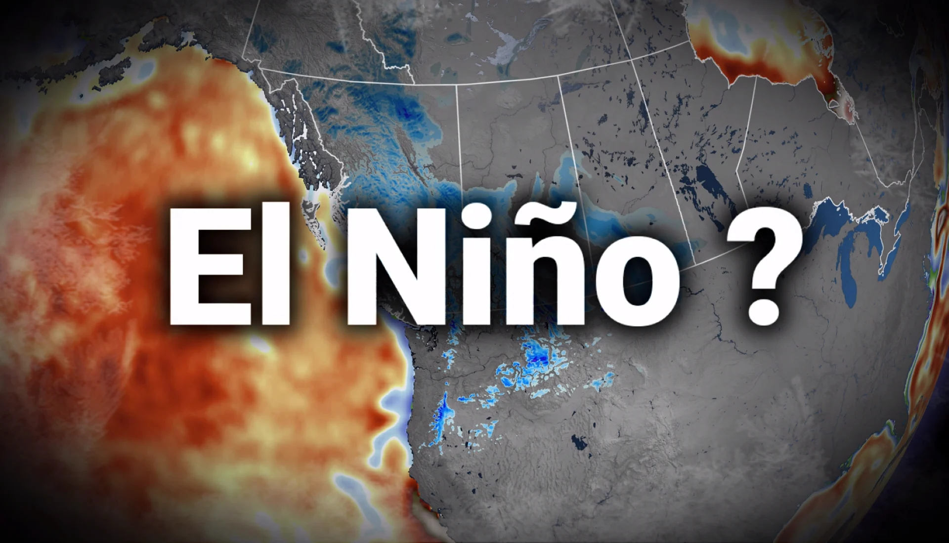
El Niño is powerful. So, why is winter weather showing up in Canada?

From ocean temperature anomalies to the split-flow jet stream, learn how El Niño is setting the stage for winter. Find out how the current El Niño is influencing the jet stream and polar vortex, impacting weather patterns and the outlook for the upcoming ski season in Western Canada.
One of the strongest El Niño events ever observed is maturing in the Pacific Ocean, so why are parts of Canada already shovelling snow?
This is more normal than one would think, and the answer has in part to do with the jet stream.
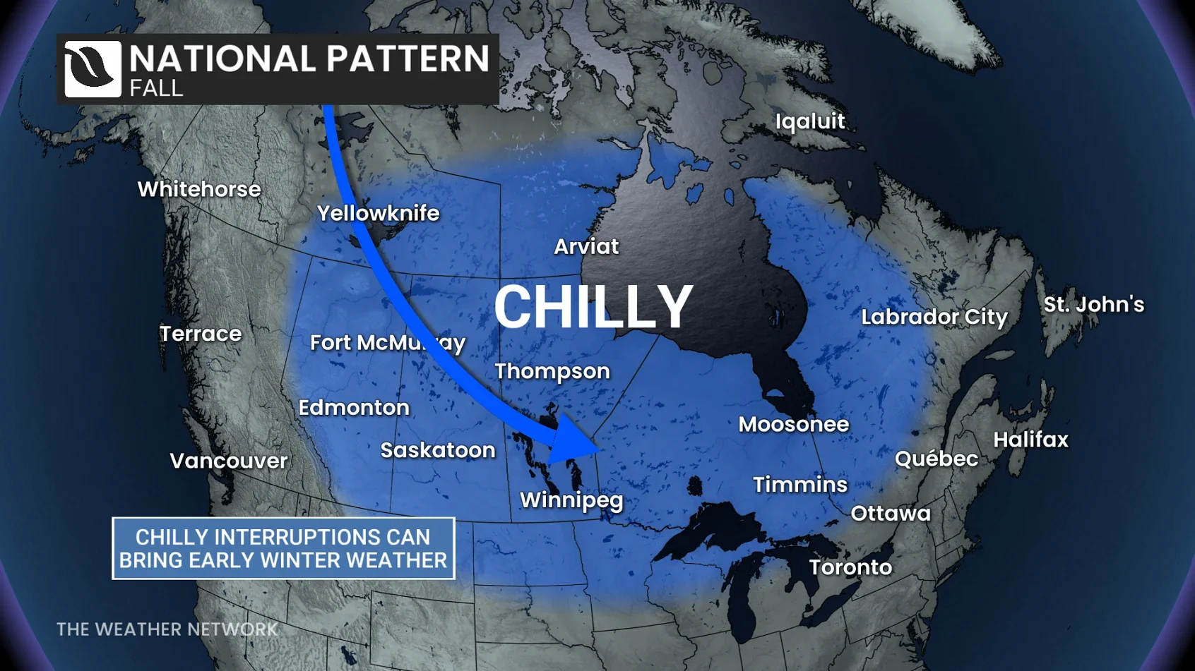
Our fall forecast did highlight some chilly interruptions to the pattern, so it shouldn’t come as a complete surprise this fall season. When we put together the fall forecast, guidance was split on whether cold air would arrive in October or November. The big uncertainty was timing. Would the atmosphere deliver the first disruption in October, or would we wait until November?
We now have an answer.
The Pacific jet stream is sputtering along
But here’s the thing.
El Niño influences the overall background state, while our jet stream determines our day-to-day weather. El Niño is not a superhero that can prevent every single intrusion of cold air, and typically El Niño reaches peak influence in the winter season when the jet stream reaches a maximum intensity.
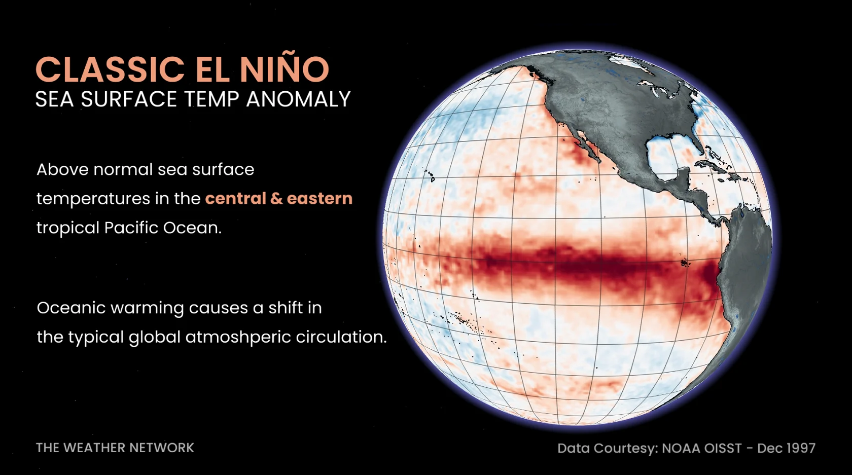
And, in a transition season like fall, the jet stream takes time to throttle up. We often get a very wavy jet stream with shorter wavelengths, and you can drain some colder air from the Arctic into Canada with relative ease.
Lately, the jet stream over the North Pacific has been fragmented and amplified, with large, northward and southward bends disrupting the usual west-to-east flow. These bends in the jet stream can create atmospheric traffic jams. Meteorologists call these blocking patterns--a persistent feature that can disrupt the normal movement of weather patterns.
Adding to the disruption, the Pacific jet stream has split into a northern and southern branch, diverting weather systems accordingly.
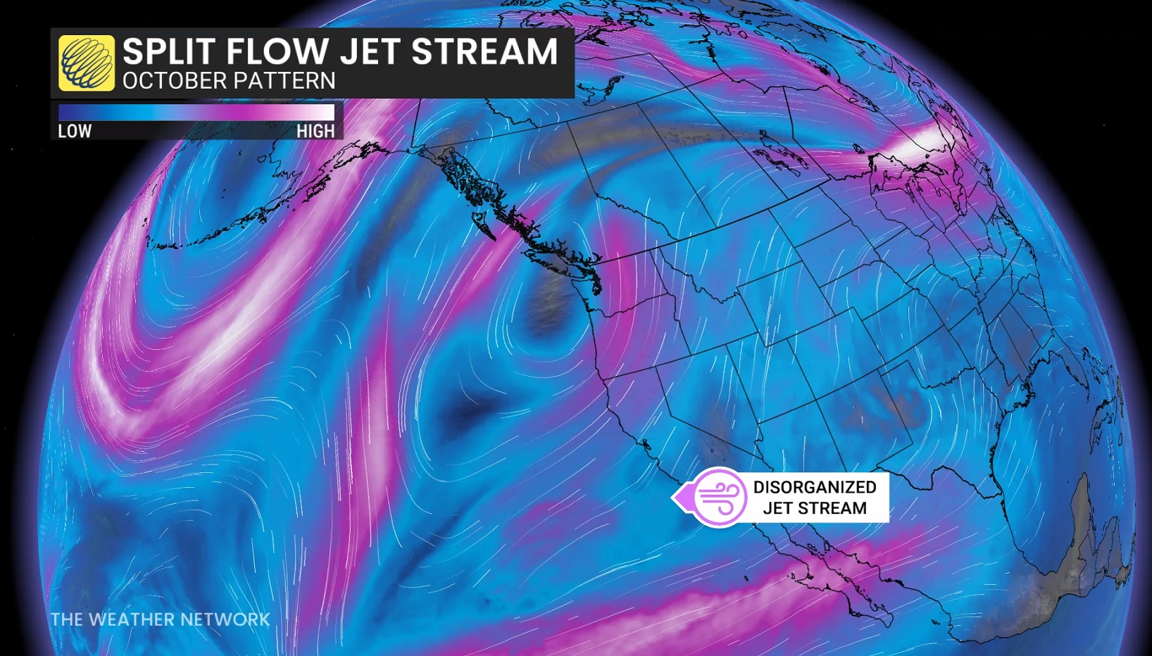
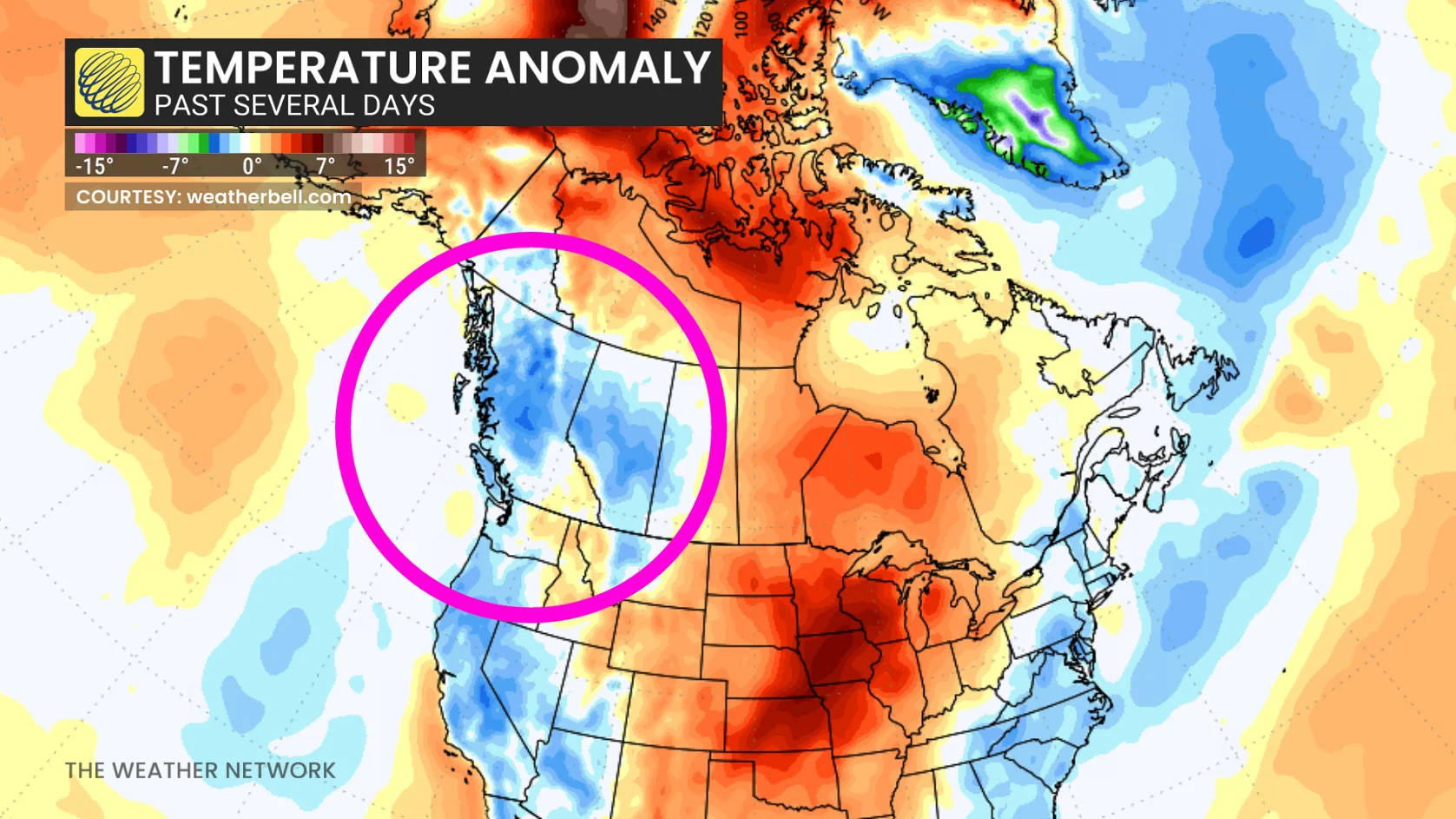
This helps in understanding why we’ve seen a taste of winter weather in Western Canada. An amplified, upper-level trough delivered the cold air, supporting widespread, higher-elevation snow in British Columbia and accumulating snow across the Prairies.
Turns out this is a normal fall El Niño pattern, after all.
El Niño is baked into the background state: El Niño didn’t disappear, but the temporary rearrangement of the upper-level pattern played the bigger role in the fall season.
Where did the cold come from? Who can we blame?
This brought in some very chilly air from eastern Siberia that was wrapped into an upper trough, delivering British Columbia a widespread alpine snowfall event, along with snowfall across the Prairies.
Another atmospheric wild card: the polar vortex
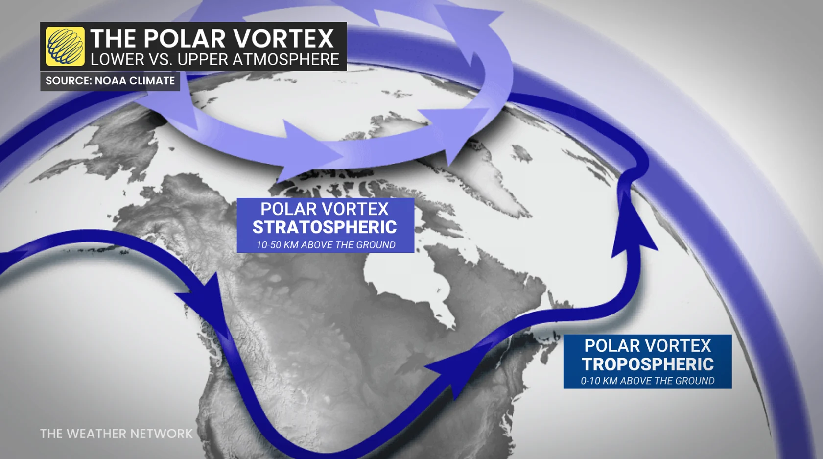
We recently talked about another unusual development unfolding much higher in the atmosphere. The stratospheric polar vortex is showing signs of an unprecedented, early-season disruption.
However, this won’t guarantee cold air will come rushing farther south. The influence is sensitive to how the circulation evolves and whether disturbances move downward through the atmosphere.
For now, our disruption to the pattern involves the jet stream being the more immediate explanation for an early taste of winter-like conditions in Western Canada.
A gift to some ski resorts
Sunshine Village: Nov. 6
Nakiska: Nov. 7
Our cautious optimism continues, even with an exceptional El Niño, which historically tilts us toward milder and often less snowy winters in Western Canada. Right now, some of Alberta’s ski resorts are just days away from opening.
Banff Sunshine Village is targeting Nov. 6, and the temperature trend as of late has been encouraging.
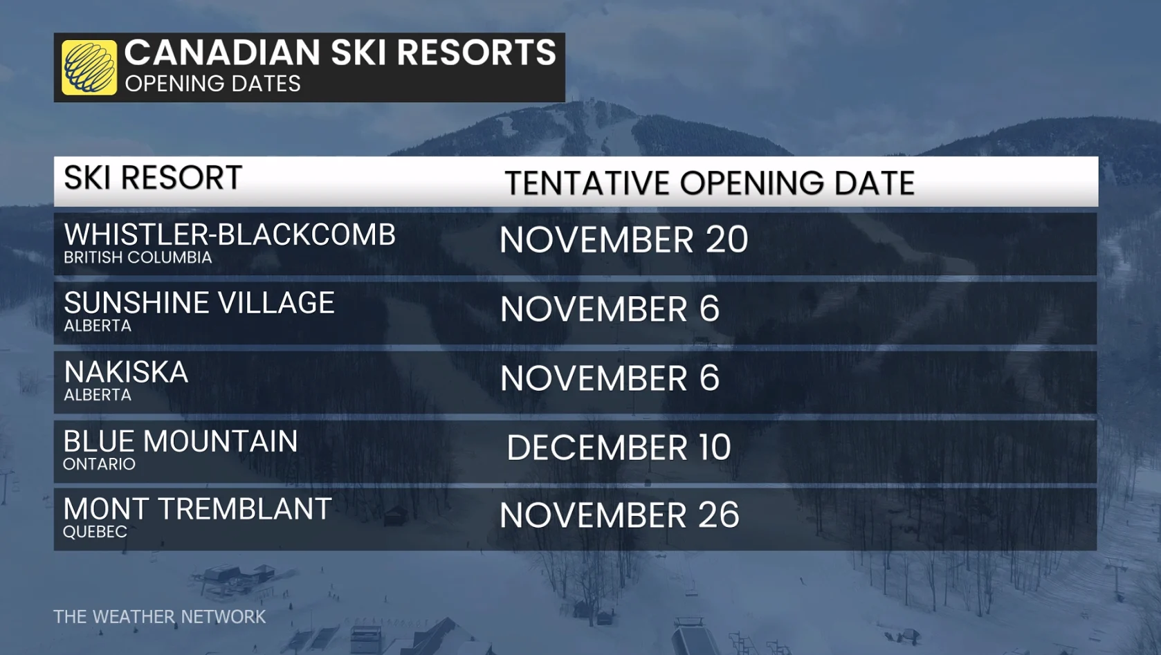
This is a gentle reminder that even though the season is forecast to be warmer-than-normal, shorter windows of very favourable temperature and weather conditions can still deliver exceptional ski conditions.
But opening a resort is a first step, and it doesn’t guarantee smooth skiing from start to finish.
B.C. mountains can have a good path into winter
British Columbia’s mountainous terrain is a blessing, and elevation is everything. B.C. doesn’t need prolific Arctic outbreaks; it just needs stability.
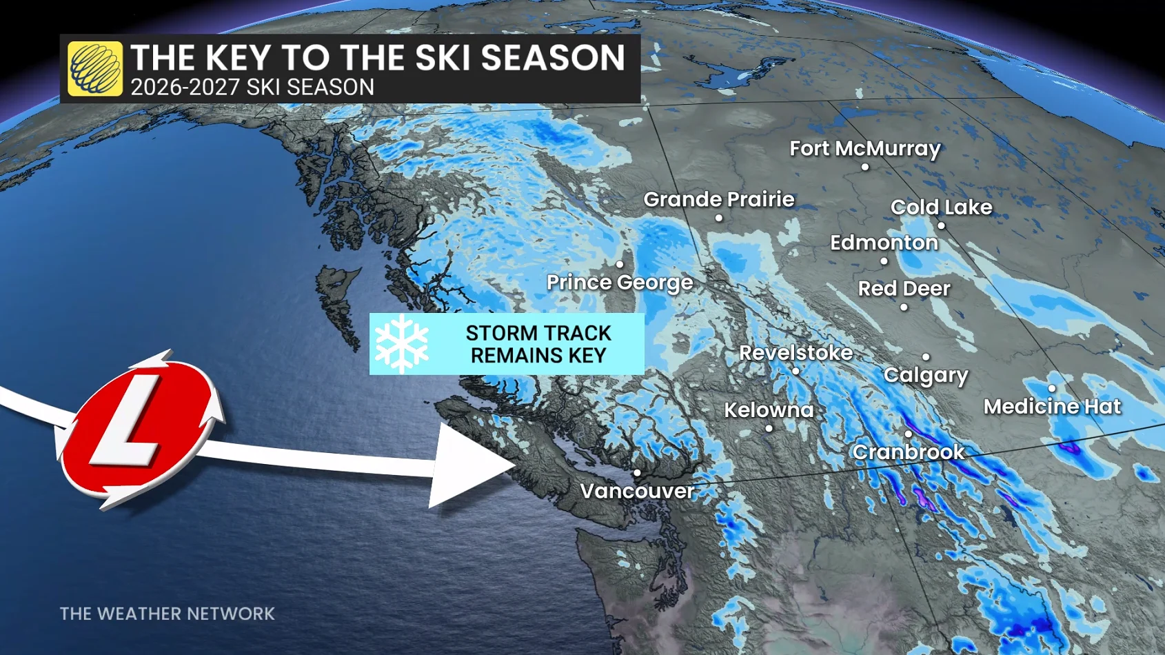
The biggest threats include warm, moisture-rich Pacific air that can send the freezing level sky-high, turning mountain snow into heavy rain.
If the dominant storm track is westerly or northwesterly in the next several weeks, this can deliver an abundance of snow at higher terrain.
Will mild weather make a comeback?
Longer-range models are hinting at a substantial pattern change across British Columbia, and this will involve a more consolidated polar jet stream that could limit the persistence of cooler air and increase heavy precipitation threats.
Keep your eyes peeled for our November outlook.
So, the lesson here is that El Niño will influence how our season ahead will play out, but it won’t write every single chapter ahead. That’s for the jet stream to decide.