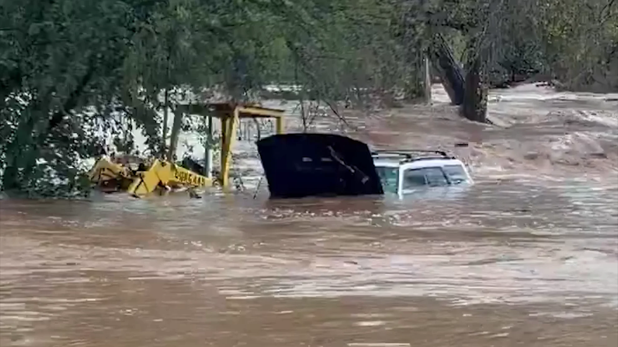
Drenching rains cause widespread flooding across the US Southwest

Heavy rainfall across the southern U.S. produced severe flooding in four separate states over the past few days.
Severe weather dumped months' worth of rain over parts of the U.S. Southwest this weekend, turning normally tranquil waterways into raging rapids and triggering historic flooding in some regions.
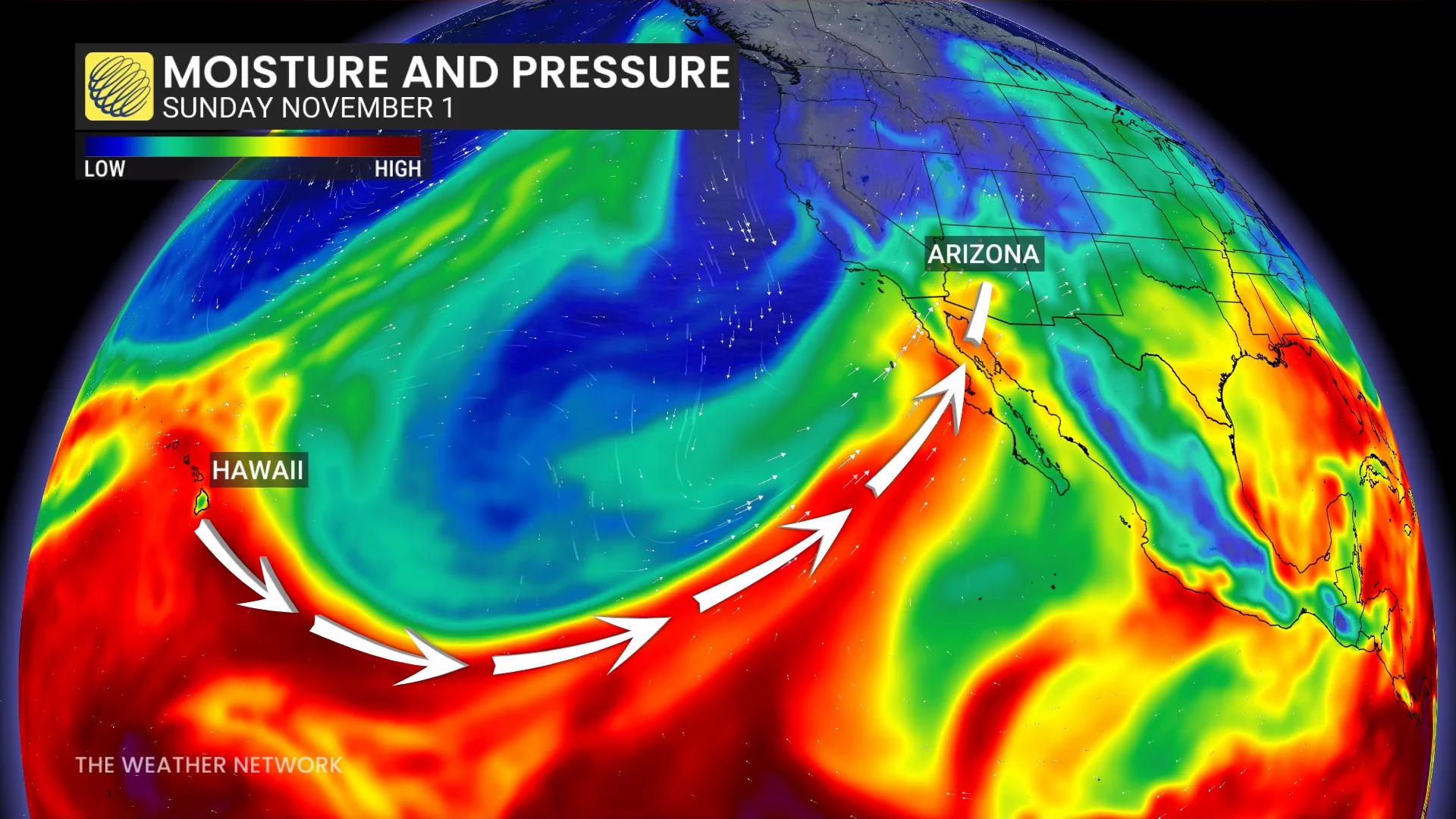
Fed by a 'Pineapple Express' funnelling warm, moist air into the US Southwest from over the Pacific Ocean, storm systems passing over Arizona this past weekend dropped hundreds of millimetres of rain, which is normally what would fall over months of time in those areas.
As a result, mandatory evacuation orders were issued for communities in Arizona, New Mexico, and Colorado due to the threat of flash flooding.
READ MORE: Flash floods target desert cities as monthslong deluge continues
According to the US National Weather Service, rainfall amounts in Navajo and Apache counties, in northeastern Arizona, reached up to 5.5 inches (140 mm) and 5.9 inches (152 mm), respectively.
Gila County, in central Arizona east of Phoenix, and Coconino County, to the north, both received over 6.5 inches (165 mm) of rain from these same storms.
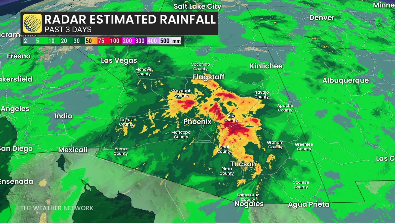
However, the heaviest rain was recorded in Crown King, AZ, in Yavapai County to the north of Phoenix. There, the rainfall total reached 7.54 inches (192 mm), which, according to NOAA's Western Region Climate Center, is only 2 mm shy of matching the wettest day ever recorded there, on April 17, 1917.
Repeated swaths of rain over the past two months have already soaked this region of the United States with between 200-300 per cent of their normal rainfall for this time of year.
Watch: Heavy rain and flooding hammer Central Arizona
READ MORE: Hawaiian moisture will travel 7,000 km to Ontario next week
The heaviest rainfall from these latest storms occurred as they encountered the mountainous regions through central Arizona, which stretch along the southern edge of the Colorado Plateau. As a result, much of the falling rain was then funnelled down the mountain slopes, directly into local waterways, causing their water levels to surge.
Along the Oak Creek, near the town of Sedona, south of Flagstaff, water levels started out at their normal depth on Saturday night, at just over 3 feet (91 cm). By 8 a.m. Sunday morning, they had risen to over 15 ft (4.5 m), causing minor flooding, and reached a maximum of close to 19 ft (5.7 m) just over 12 hours later, resulting in moderate flooding. Residents nearby were ordered to leave immediately as the floodwaters trapped several people inside their homes.
The small community of Gisela, on the banks of the Tonto Creek in Gila County, AZ, was completely evacuated due to rising waters. While the normal level of the Tonto Creek is about two and a half feet, it reached a level of 16 ft (4.8 m) around midday Sunday, which is the creek's 'minor flood stage', before the monitoring station stopped reporting due to "flood damage."
Watch: Dramatic rescues as parts of Arizona flood, trapping drivers
In Flagstaff, intense rainfall on Sunday overwhelmed the city's storm drains, turning streets into flowing rivers. In Tucson, authorities were busy with around a dozen water rescues across the city due to river flooding. Plus, in some counties, such as La Pala in southwestern AZ, all public roads were closed due to floodwaters.
Communities in southern Colorado and northern New Mexico were also impacted by the deluge of water from these storms, with some given mandatory evacuation orders.
Specifically in Pagosa Springs, a town in southern Colorado popular with tourists, residents were forced to evacuate due to the potential for "catastrophic flooding" from the rising waters of the San Juan River.
Meanwhile, in Florida...
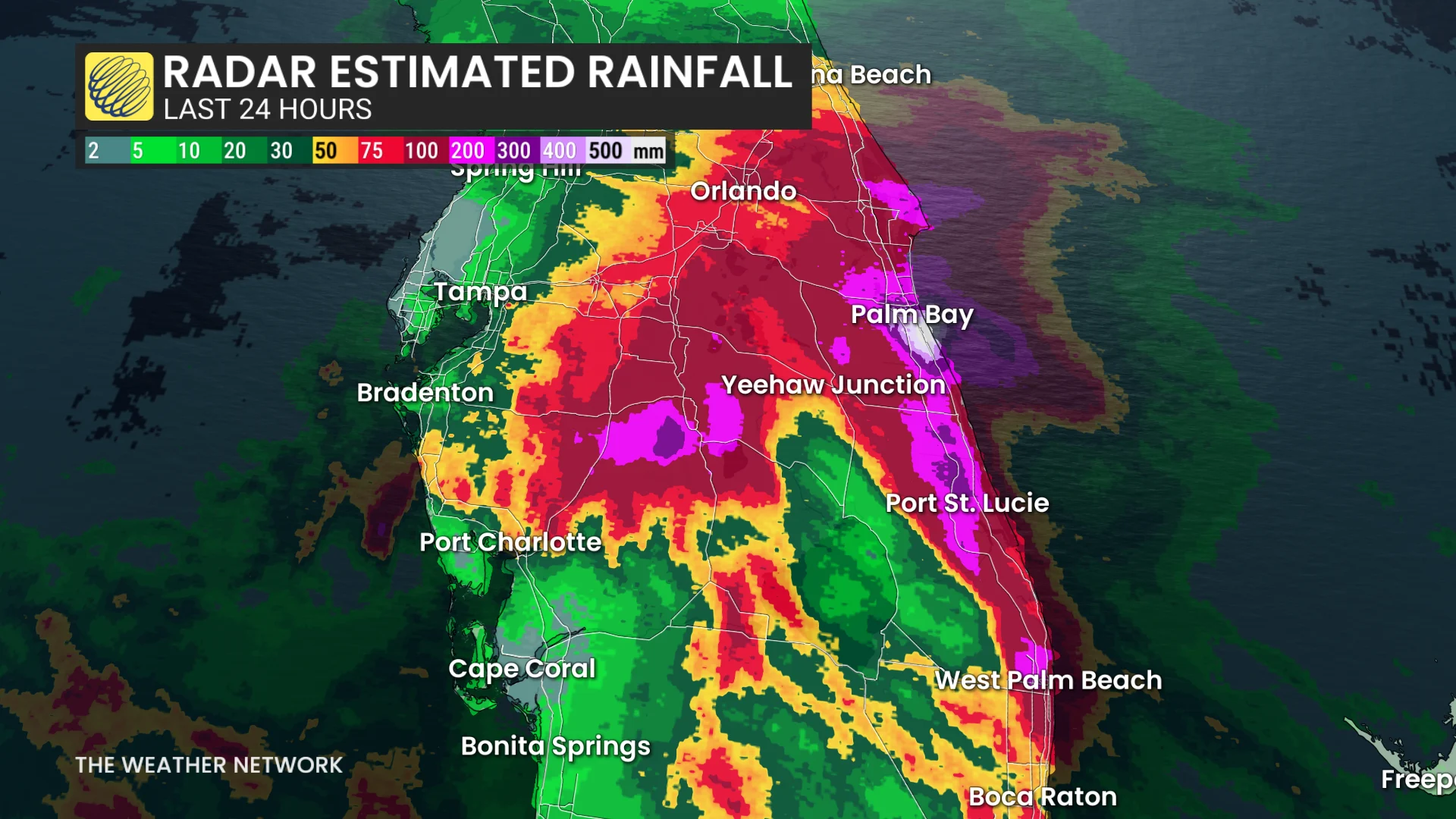
While these storms battered the Southwest, in the US Southeast, persistent onshore flow from the Gulf of Mexico over the Florida Peninsula resulted in repeated rounds of heavy rainfall on Sunday and Monday, November 1-2.
READ MORE: Plane crashes in Florida during severe weather, killing nine occupants
According to the National Weather Service, Malabar, FL, along the coast, south of Palm Bay and southeast of Orlando, saw the heaviest downpours, as it received over 24 inches (612 mm) of rain from this weather pattern as of 9 p.m. on Monday. Nearby Palm Bay saw over 20 inches (523 mm), and West Palm Beach, farther down the coast, had a total of 22.2 inches (564 mm) by Monday night.
The NWS also reported that flash flooding from these repeated lashings of rain had closed roads around the Melbourne and Palm Bay areas, with floodwaters affecting homes in West Palm Beach, Riviera Beach, and Palm Beach Gardens.
(Thumbnail image courtesy Yavapai County Sheriff's Office)